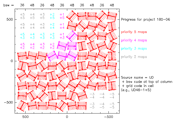
This project aims to make maps at 100 positions in a 10 x 10 grid. Each position has been given its own "source" name in the database: UD##XXXX, where ## indicates the wobbler throw that should be used for that position (either 36 or 48) and XXXX indicates its location in the 10 x 10 grid (e.g., UD36+5+5).
The following figure shows all 100 positions in the field. "Sources" that have already been observed show mini-maps indicating the directions of their subscans (thin lines). "Sources" that have not yet been observed still show the numbers that are part of their names.

If you are about to start a new map for project 180-06,
(1) Note the current LST.
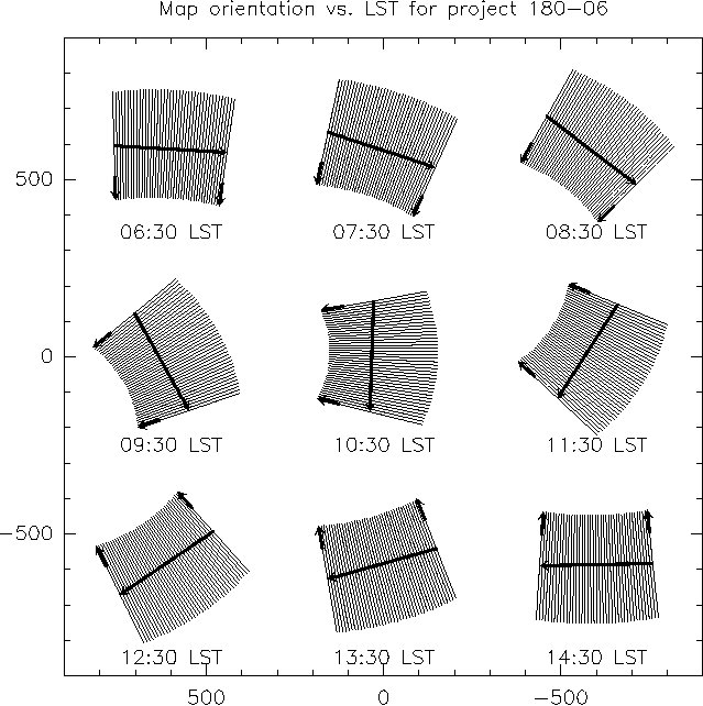
(2) Determine the approximate subscan direction that will result for a map starting at the current LST, by referring to the figure *below*.
(3) Find a high-priority position in the figure *above* whose neighbors have been mapped (if at all) with different subscan directions from a map starting at the current LST. (Neighbors with perpendicular subscan directions are ideal.)
(4) Determine the "source" name for this position: UD + wobbler throw (from top of column) + grid position (from cell). This is the "source" you should map following the instructions in the obsform.

The Co-PIs will try to update the top figure on a daily basis, but in case we miss a day you should still check on the project page in the database that the "source" you have chosen has not already been observed. If you have questions, contact us at ajbaker@physics.rutgers.edu and omont@iap.fr. We thank you in advance for your hard work!
Last edited 2007-04-03 by A. Baker using
1046progress-2007-04-03.mopsic
Back to Pool page: PoolObserving